Sometimes you just need a good adventure to work the cobwebs out of your day-to-day existence… Yesterday was quite the adventure.
While we discussed the day’s plans Aryntha demonstrated his grill-mastery once again by whipping up some really good veggie-burgers. See, Rai’s a vegetarian and probably the healthiest of us; so while Aryntha and I chow down on all kinds of thing things that would clog the arteries of the DC metro system, Rai does stuff like salad and veggie burgers. Yesterday was my first meatless meat puck but with Aryntha at the helm of the grill it was actually quite good.
After some debate we decided to do a little telephone system spelunking and, after consulting the circa 1976 bellcorp facilities map we have at our disposal and Aryntha’s amazing Phozone detection abilities, our target was originally going to be a few ancient sites near Craig Colorado. Of course, as with any group of hardcore geeks like us, this determination took quite a while with the mapping, internet lookup, route planning, GPS verification, and battery charging…
Well, by the time we were ready to depart we determined that it was just too late in the day to trek though the mountains and halfway across Colorado so we settled for something a bit closer, Leadville.
The telephone infrastructure is mostly based in the “front range” of Colorado which, oddly enough, is where all the people are. Most of the towns here in the high country didn’t have, or probably want, telephone service till the resort expansions of the late 60’s and early 70’s. By then cable and later optical high capacity systems were in play which allowed the central office to be located quite a ways from the customer. Leadville was a terminus on the southern Colorado microwave carrier route which, as I-70 didn’t exist back then, was routed south along highway 50 though places like Salida. So this makes the Leadville switch a real piece of history and off we went…
The drive south along Highway 24 from Minturn to Leadville takes one through some of the best scenery in Colorado.
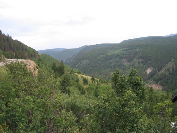
It’s a steep, deep canyon called “Dark Territory” that was carved by the Eagle and Homestake Rivers and takes you past such notable things as Red Cliff which is a picturesque little mountain town virtually unchanged since the mining era of Colorado, Notch Peak which rises up above the canyon to a height of 14,307 feet, and the truly odd “modern” ghost town of Gilman which sits at 11,000 feet.
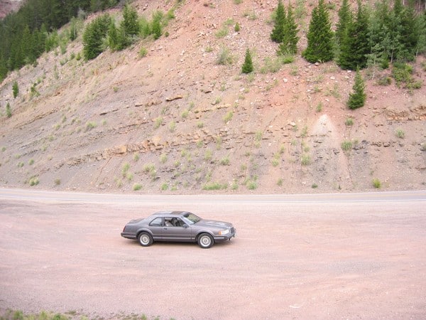
The drive from Minturn to Leadville normally takes about 45 minutes and is 33 miles; we did the distance in a record 1 hour, 28 minutes as we stopped at every turn out on the road so Aryntha could take lots of pictures. Here’s one of the “USS Lincoln”, my car and the vehicle we generally take on road trips.
By far the longest stop was at Gilman which is a ghost town that supported the Eagle Mine and was founded in 1886.
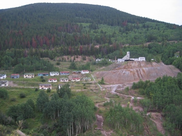
At its high point had over 2000 residents and in 1950 the output from the mine, which was primarily zinc, was valued at 13 million annually. Giman was populated until the EPA closed the town in 1984 due to heavy metals contamination, such as arsenic (commonly found with lead and zinc), of the upper Eagle River. As of 1996 the EPA has assessed that there is no further risk to humans or wildlife by this site and recently they issued their 5 year review which showed yet more improvement thanks in part to the heroic work that the owning company, Viacom, has done over the years by plugging and flooding the mine and installing a heavy metals extraction plant at the site.
The reason we were so interested in photographing Gilman is because the current rumor has it that Vail Associates (the multi-national octopus organization that runs the Colorado high country these days) plans to buy Giman to make yet another resort town… Gilman is located on the back side of Vail’s ski runs and with the addition of a chairlift up through the valley to the north east of Gilman, could take folks to the top of the runs in minutes. So it’s entirely possible that this long standing testament to what people shouldn’t do to the environment, will be converted into hotels and stores in a few years.
Anyways we eventually made it to Leadville and with Aryntha’s amazing Phozone detection abilities he put us on the only road in town where you can see the microwave tower for the old central office. The central office for Leadville is quite a bit smaller than one would expect and we summize that it probably still contains the original ESS1A switch that was popular on the Colorado routes. What was truely odd, and something that will require further investigation, is the fact that the microwave horn faces north east to a passive repeater on a peak near the highway 24 and 91 merge. The microwave horn should have been, according to the facilities map, pointing south towards Twin Lakes as the route back in 1976 came from there and ended in Leadville. This usually means they’ve “turned down” Twin Lakes in favor of a route towards Copper Mountain. This isn’t on our map, so of course we *must* annotate this new route for posterity and go find out what happened to Twin Lakes. We took lots of pictures for archival then headed back to Minturn to have dinner at Chilly Willy’s.
We briefly returned home to gather radios, lights and other equipment of the trade before heading back to highway 24 so we could get a “better view” of an odd antenna bearing hut we found on the way to Leadville. The trip was a bust as it turned out to be nothing but we chalked it up to practice.
Once we returned to the château here we called it a night as it was about midnight.
Thus ended Thursday, which was a most excellent adventure.